

History of Weather Radar
During World War II, military radar operators noticed noise in returned echoes due to weather elements like rain, snow, and sleet.
Just after the war, military scientists returned to civilian life or
continued in the Armed Forces and pursued their work in developing a use
for those echoes. In the United States, David Atlas, for the Air Force group at first, and later for MIT, developed the first operational weather radars. In Canada, J.S. Marshall and R.H. Douglas formed the "Stormy Weather Group
" in Montreal. Marshall and his doctoral student Walter Palmer are well
known for their work on the drop size distribution in mid-latitude rain
that led to understanding of the Z-R relation, which correlates a given
radar reflectivity with the rate at which water is falling on the ground. In the United Kingdom, research continued to study the radar echo patterns and weather elements such as stratiform rain and convective clouds, and experiments were done to evaluate the potential of different wavelengths from 1 to 10 centimetres.
 |
| Radar image of tornado-producing supercells |
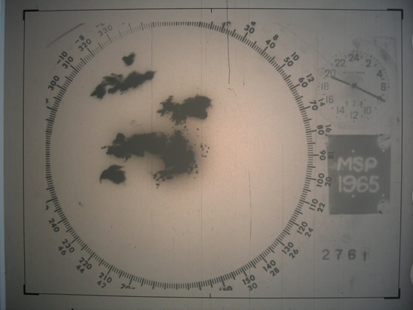
Between 1950 and 1980, reflectivity radars, which measure position and intensity of precipitation, were built by weather services around the world. The early meteorologists had to watch a cathode ray tube. During the 1970s, radars began to be standardized and organized into networks. The first devices to capture radar images were developed. The number of scanned angles was increased to get a three-dimensional view of the precipitation, so that horizontal cross-sections (CAPPI) and vertical ones could be performed. Studies of the organization of thunderstorms were then possible for the Alberta Hail Project in Canada and National Severe Storms Laboratory (NSSL) in the US in particular.
The NSSL, created in 1964, began experimentation on dual polarization signals and on Doppler effect uses. In May 1973, a tornado devastated Union City, Oklahoma, just west of Oklahoma City. For the first time, a Dopplerized 10-cm wavelength radar from NSSL documented the entire life cycle of the tornado. The researchers discovered a mesoscale rotation in the cloud aloft before the tornado touched the ground : the tornadic vortex signature. NSSL's research helped convince the National Weather Service that Doppler radar was a crucial forecasting tool. The Super Outbreak of tornadoes on April 3–4, 1974 and their devastating destruction might have helped to get funding for further developments.[citation needed]
Between 1980 and 2000, weather radar networks became the norm in North America, Europe, Japan and other developed countries. Conventional radars were replaced by Doppler radars, which in addition to position and intensity could track the relative velocity of the particles in the air. In the United States, the construction of a network consisting of 10 cm (4 in) wavelength radars, called NEXRAD or WSR-88D (Weather Service Radar 1988 Doppler), was started in 1988 following NSSL's research. In Canada, Environment Canada constructed the King City station, with a five centimeter research Doppler radar, by 1985;McGill University dopplerized its radar (J. S. Marshall Radar Observatory) in 1993. This led to a complete Canadian Doppler network between 1998 and 2004. France and other European countries switched to Doppler network by the end of the 1990s to early 2000s. Meanwhile, rapid advances in computer technology led to algorithms to detect signs of severe weather and a plethora of "products" for media outlets and researchers.
After 2000, research on dual polarization technology has moved into operational use, increasing the amount of information available on precipitation type (e.g. rain vs. snow). "Dual polarization" means that microwave radiation which is polarized both horizontally and vertically (with respect to the ground) is emitted. Wide-scale deployment is expected by the end of the decade in some countries such as the United States, France, and Canada.
Since 2003, the U.S. National Oceanic and Atmospheric Administration has been experimenting with phased-array radar as a replacement for conventional parabolic antenna to provide more time resolution in atmospheric sounding. This would be very important in severe thunderstorms as their evolution can be better evaluated with more timely data.
Also in 2003, the National Science Foundation established the Engineering Research Center for Collaborative Adaptive Sensing of the Atmosphere, "CASA", a multidisciplinary, multi-university collaboration of engineers, computer scientists, meteorologists, and sociologists to conduct fundamental research, develop enabling technology, and deploy prototype engineering systems designed to augment existing radar systems by sampling the generally undersampled lower troposphere with inexpensive, fast scanning, dual polarization, mechanically scanned and phased array radars.
Added link to your blogpost in a collection of articles on weather radar. The collection starts with your article only.
ReplyDeletehttp://nraoetkc.blogspot.in/2012/07/weather-radar.html
Thanks a lot for adding article.
ReplyDelete